Whilst searching boxes of books, I came across my Dad’s Wills and Senior Service cigarette albums. One dates to a school year and internet searches suggest they date to 1938 and 1939. They are a fascinating record of different rates and type of changes to land/ town scapes and working / leisure lifestyles. The 1939 album is called Beautiful Scotland and from my different times living and visiting the country, I can compare my photos and other resources from the last 20 or so years.
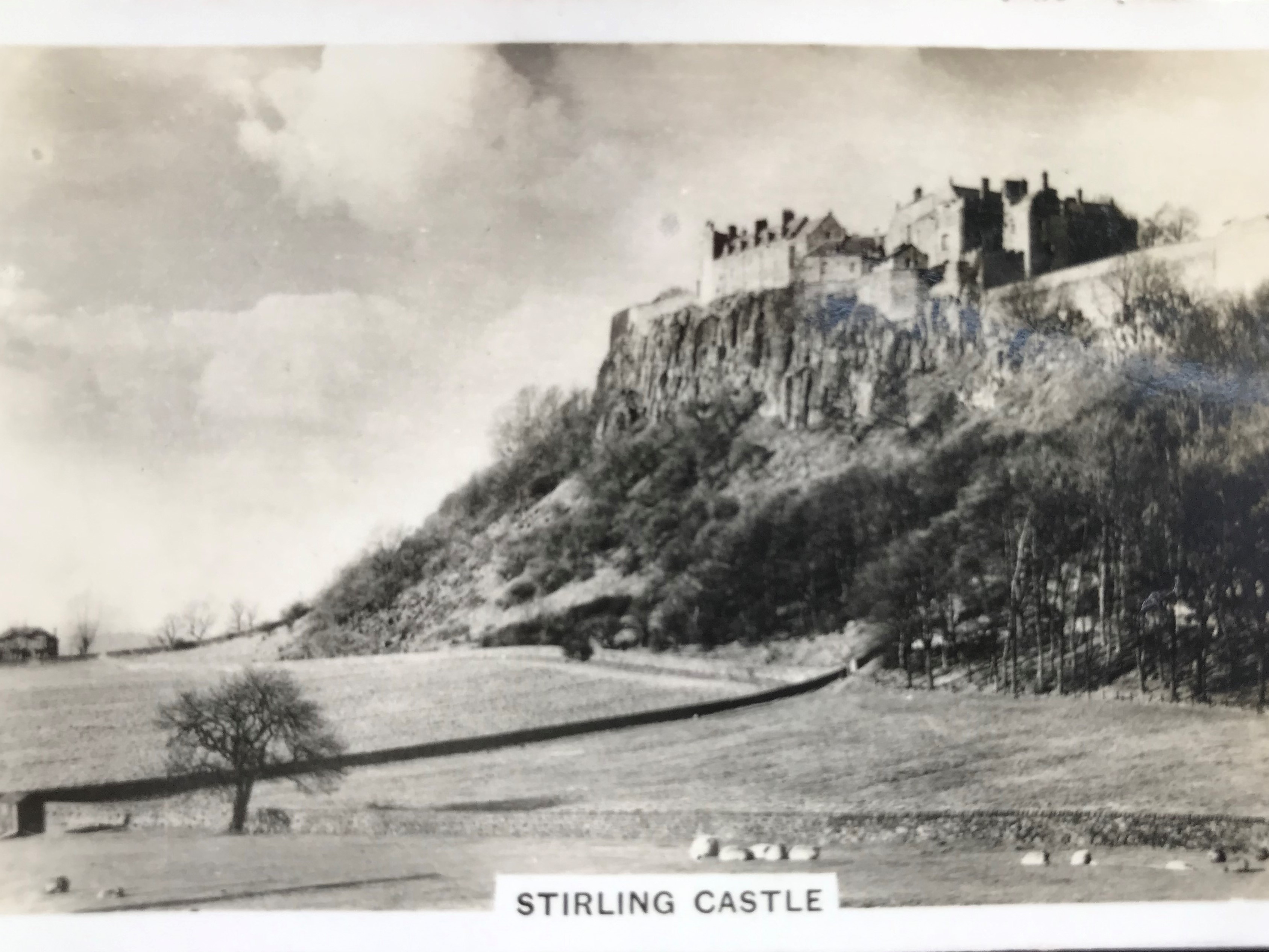
Stirling Castle
Although there’s now more tree cover on the slope to Stirling Castle than in 1939, the setting is still essentially the same.

Stirling Castle Beautiful Scotland Series – Senior Service 1939
I’ve good memories of a small Italian restaurant, foxtrot and rumba moves and visit around the Castle. I searched the registers trying to find a record for a great uncle whom we believe served in a Scottish regiment and then wandered around the adjoining graveyard in decreasing late afternoon light to try and find a name inscription. It was classic dreich weather with grey hues from walls, gravestones and paths blending with the lowering cloud cover and rain. Although on a visit some years ago relatives found a memorial, I was unsuccessful in both the registers and graveyard. A quest for another visit.
I recall the exquisite embroidery skills evident in using traditional techniques to create a replica of the 7 tapestries of Hunt of the Unicorn. These were known to have been  hung on the Castle walls in the 16thC.(Wikipedia – free to use & share)
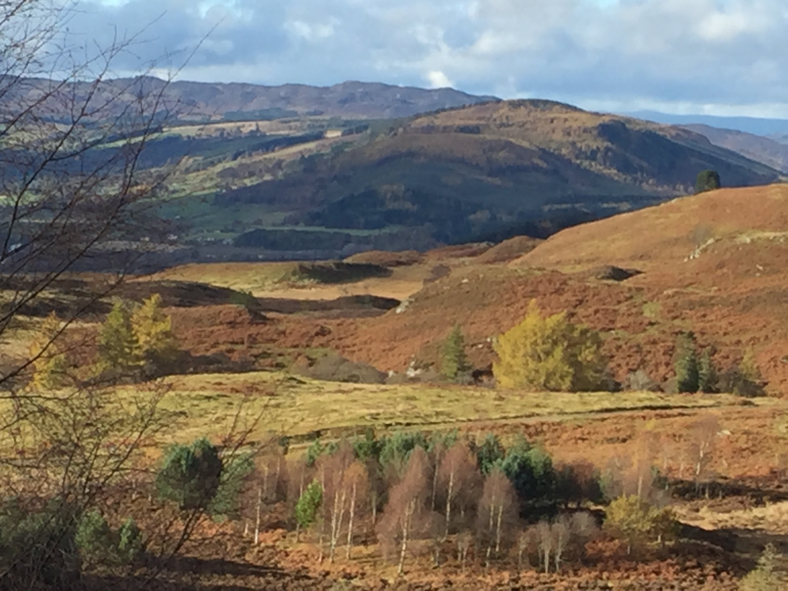
Glen Tilt Perthshire
Two cards are of Glen Tilt and a roadbridge to Forest Lodge, which linked to a drove road through the Glen to the Cairngorms and then by footpath to the Larig Ghru and Deeside or Speyside.
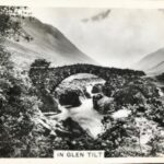
I recall walking part of the Larig Ghru during University days. Years later in June 2012, I visited Glen Tilt as part of a small group, with Dad as his birthday present aged 77, to walk between Bynack Lodge via the Allt Garbh Buidhe to the road. Although I knew access rights have been hotly contested, I didn’t know the 6th Duke of Atholl had a bitter court dispute with a party of wandering botanists in 1847.

Allt Garbh Buidhe 2012 walk
I’d heard of James Hutton the geologist 1726-1797, but unaware this was the locality where he found rock intrusions to support his theory of Plutonism, whereby heat from the earth’s interior caused the uplifting of rocks from beneath the sea, in contrast to a contemporary theory that rocks were formed by precipitation out of water. In Glen Tilt he found boulders of the country rock intruded with, at one time molten, granite veins.
Glen Affric – Highlands
Another Highland scene is of Glen Affric in winter with scattered pine trees by the loch and snow capped mountains. I’ve visited couple of times such as on a beautiful, but cold, autumn day in 1991 when there was also snow on the tops.
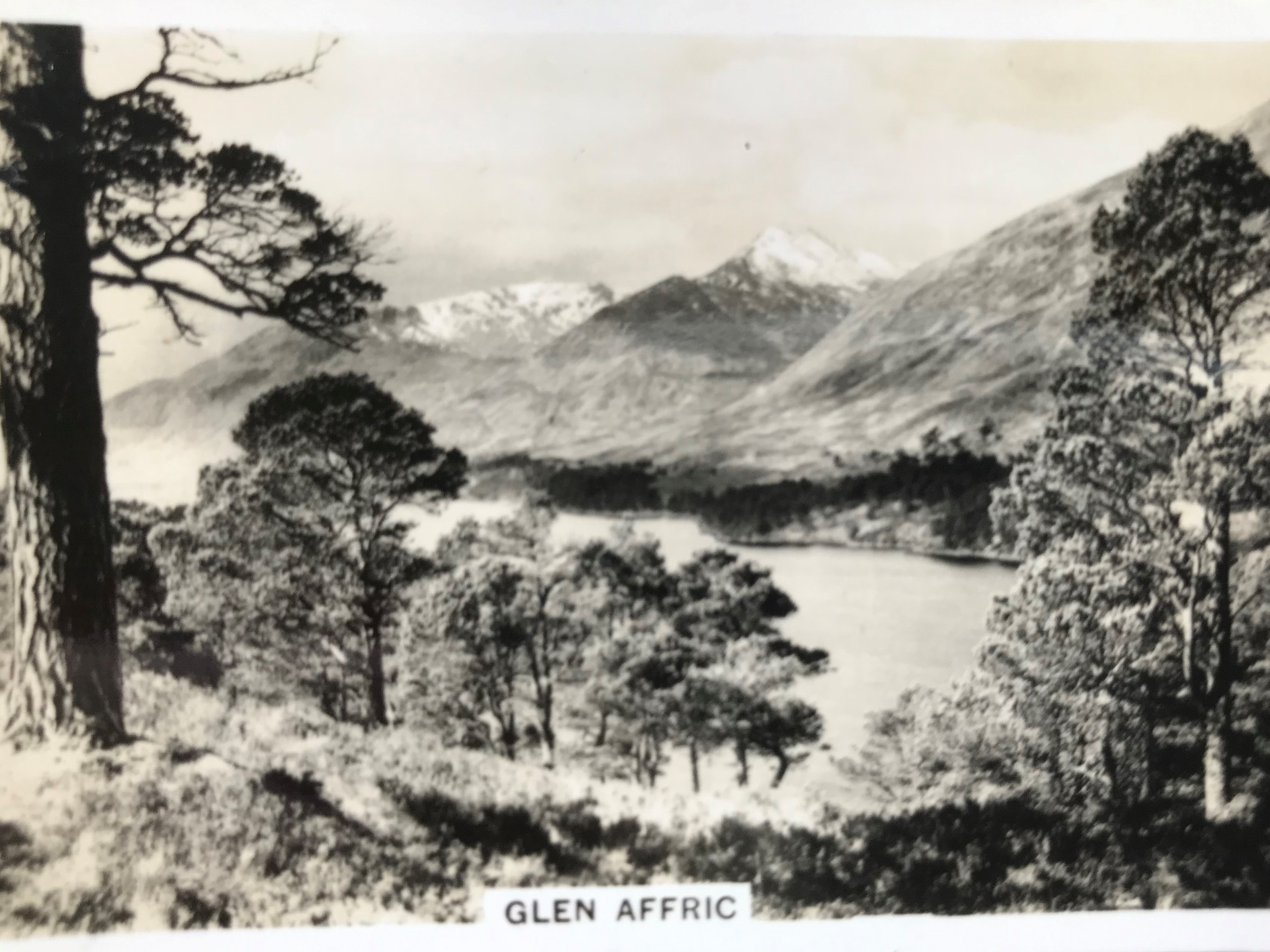
The 1939 card says there are ‘frequent excursions by road, rail and steamer from Inverness during the season with the road going through Chisholm’s Pass a defile of great grandeur and beauty . The road winding through a forest of birch often attains a height of 300′ above the river’.
Lord Tweedmouth restored the Lodge in the 19thC and gave this and 32000 acres to a daughter on her marraige in the 1870’s – wow what a wedding gift!.
1991 walk
The Scottish National Forest Estate purchased substantial areas in early-mid 20thC and planted up with Sitka spruce, Lodgepole pine and Scots pine. The card shows the landscape prior to such afforestation.
The current draft Management Plan for the National Nature Reserve has 50 and 300 year visions to revert, in some ways, to the 1939 card vista eg to restore / expand the classic Highland landscape of Caledonian native pine forest, lochs. mountains and open moorland habitats as strongholds for wildlife such as black grouse, golden eagle, wildcat, red squirrel and mountain willows.
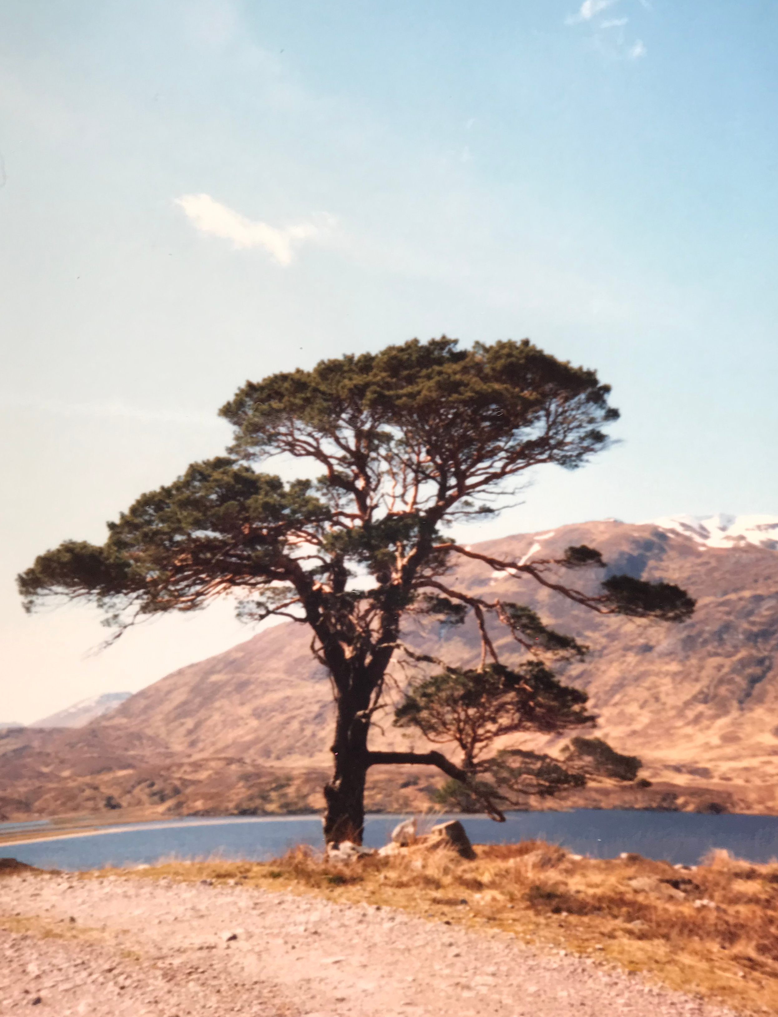
Loch Torridon
I’ve had several trips along the west coast such as around Loch Torridon. The 1939 shows a ruined croft building and stone walls as foreground to the ‘scenery of great grandeur and beauty’ of hills and water.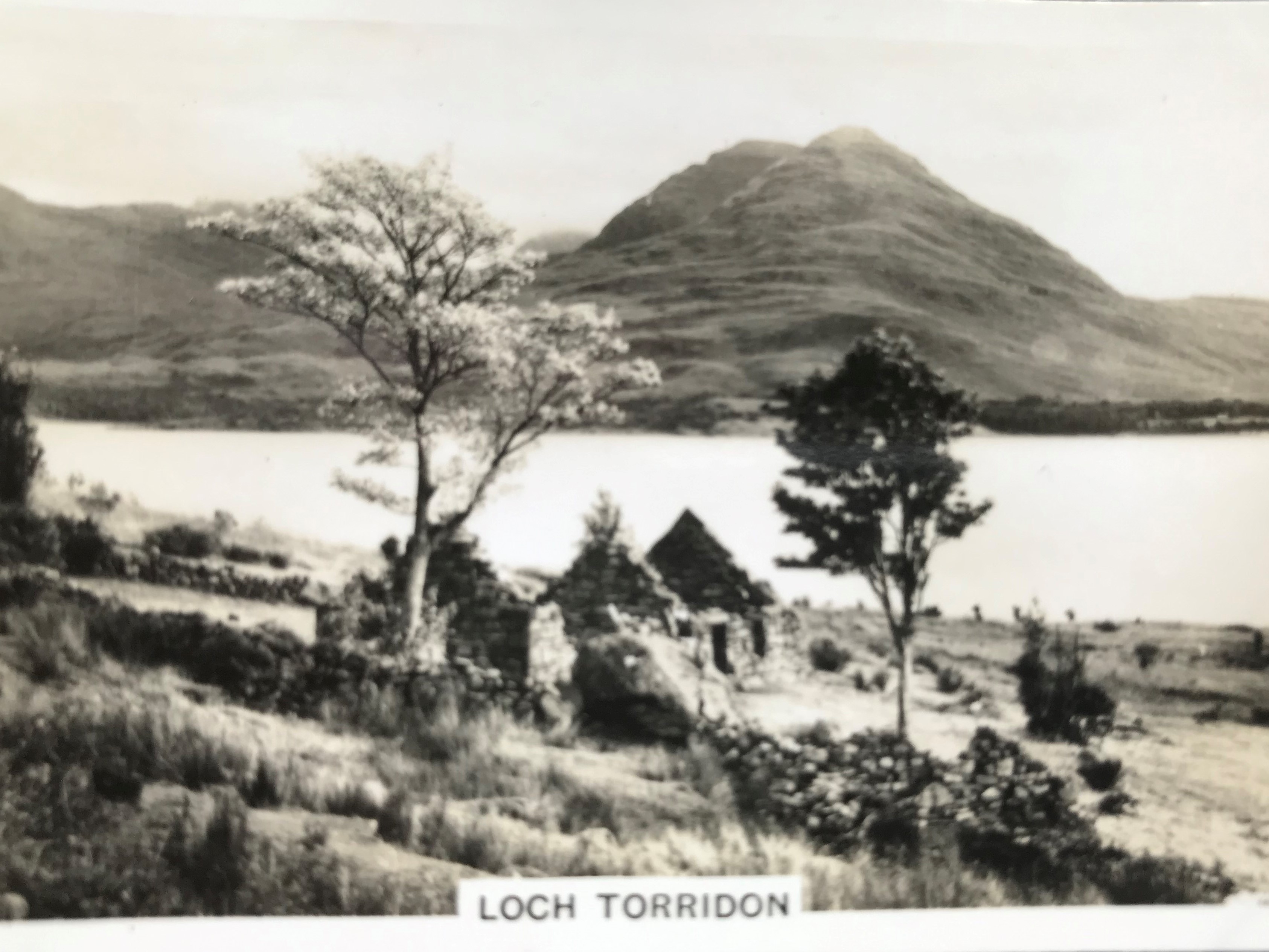
One of my trips in 1991 was 3 days backpacking with couple of friends from the road end at Lower Diabaig northwards to a small basic hostel at Craig.
Only 2 miles but it felt remote although lucky in having great weather and photos show us in shorts and T shirts.
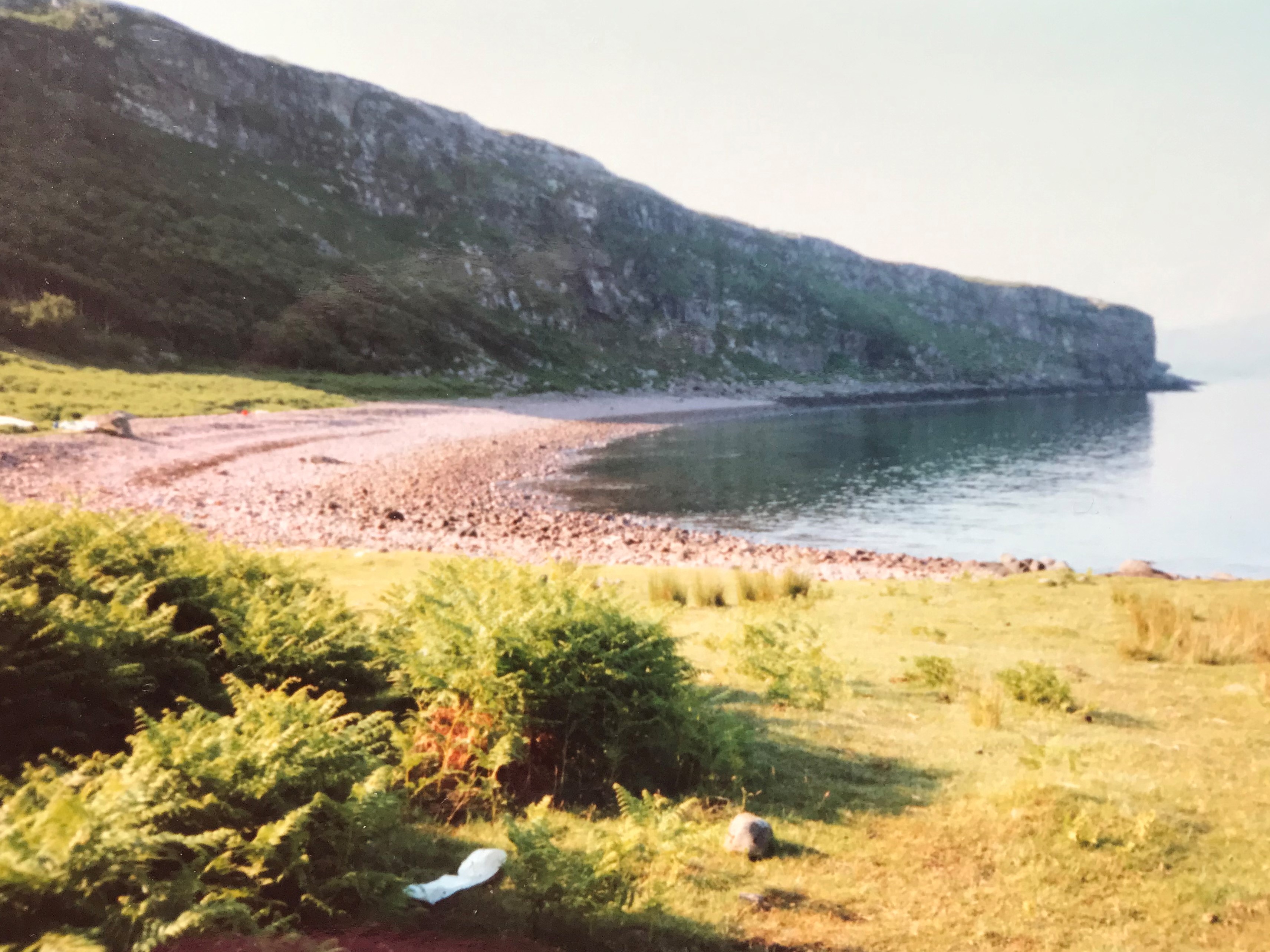
Bay near Craig YH
I recall being told we followed the postman’s path which must have kept folk fit, this activity had been recently banned due to H&S. I distinctly remember washing in the cold stream, a basic supper, a temporary warden and this cove where supplies often came by boat.
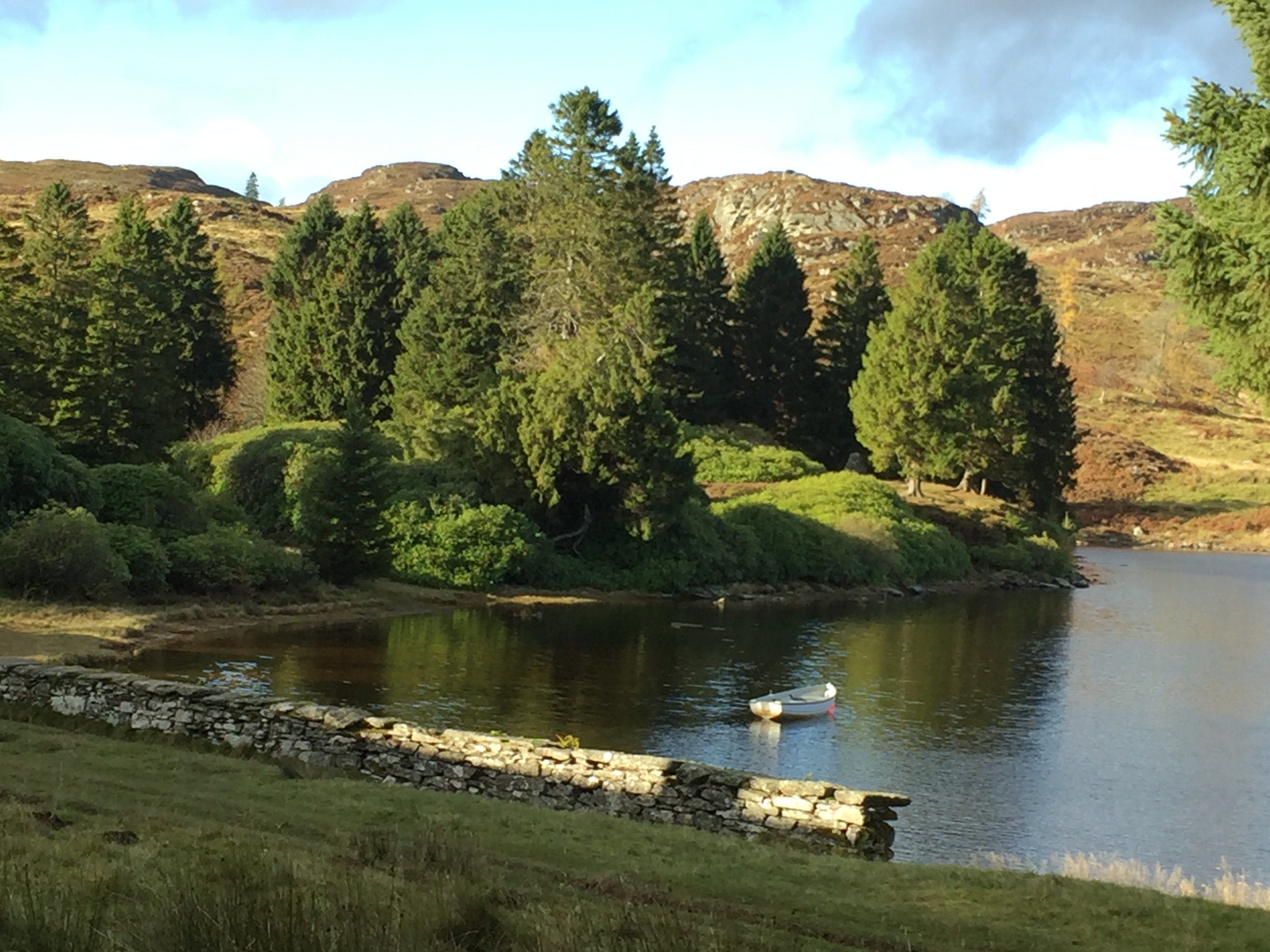
River Tay – Dunkeld / Birnam
There’s a birds eye 1939 view of the River Tay from Birnam, showing a bridge, fields, mixed woodland and a big house in formal gardens. It is not easy to match with current mapping, but possibly from an OS 1:50000 series map updated 1967-1974 it is the downriver view over Dalbeathie House area towards the bridge at Caputh.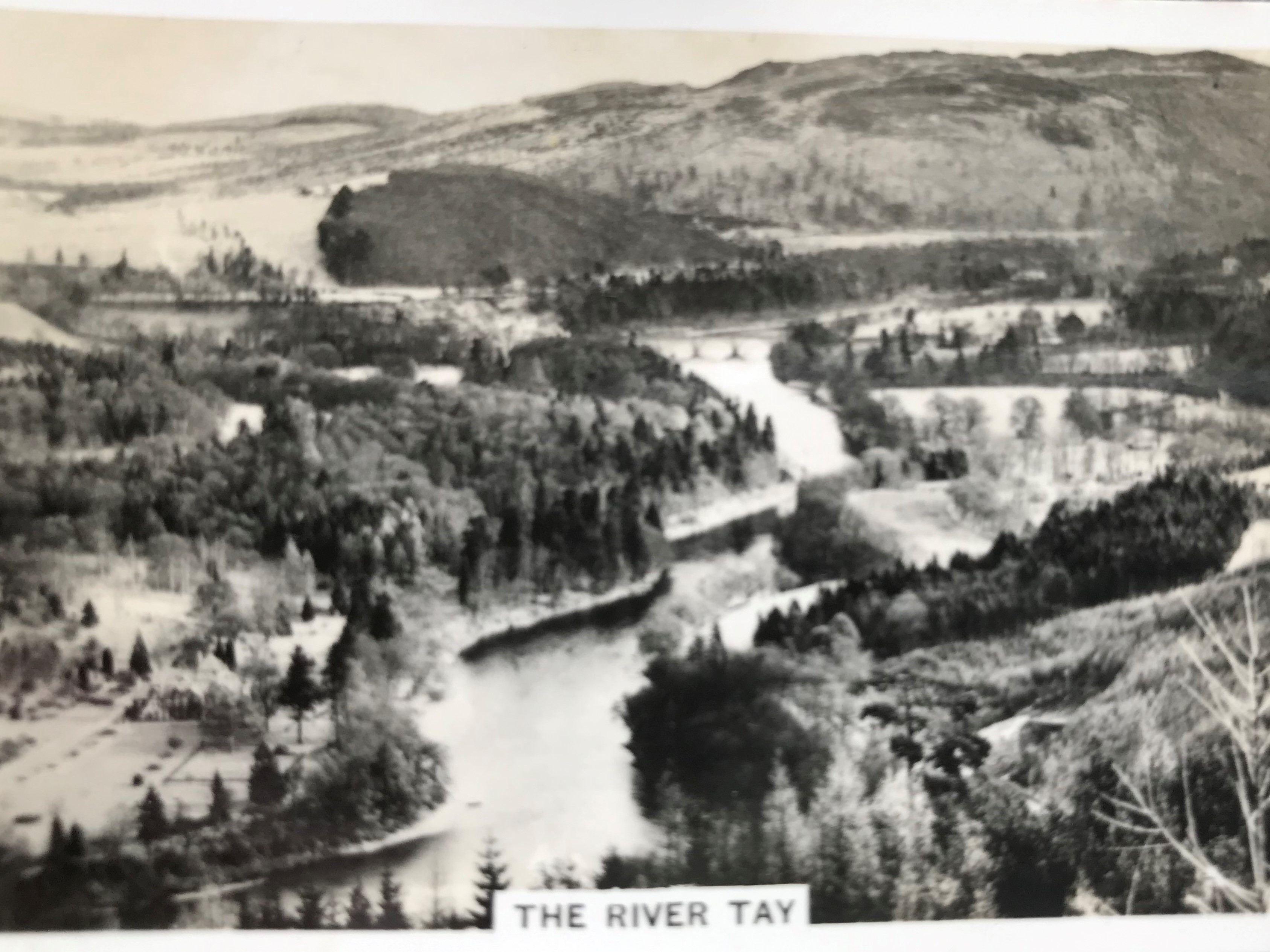
I’ve had bike rides, walks and field training course on wildcat and pine martin around Dunkeld and Birnam which lie on opposite river banks. I recall getting off the over-night sleeper from Kings Cross at about 0530. Fortunately, although cold it was dry, to wander with backpack along the River to the Birnam Oak. This is believed to be the only remaining tree from Birnam Wood of Shakespeare’s Macbeth. Then over the Thomas Telford stone bridge of 1809 to the rebuilt 18thC country town and the Cathedral churchyard with a long history to early times of Celtic christianity. After such exploration I went into a hotel for breakfast and a leaving visitor offered me their room for an hour to wash and brush up! Other visits were walks around Loch of Lowes with a friend, recuperating from a near fatal viral infection, and see one of the ospreys recently ‘back’ from West Africa.
In autumn 2017, I had a grand 15 mile walk from Dunkeld northwards to Loch Ordie in Forest of Clunie, namely elevated moorland as a historic royal hunting forest. Loch Ordie gave its name to one of Scotland’s most useful and famous trout flies.
Dunkled walk Nov 17 – vie NW over R Tay from track west of Deuchary Hill
Loch Ordie
Stornoway
The 1939 card of Stornoway shows 3 piers where construction of solid quays and 3 timber wharves was underway in 1881. A current town map has these quays as Esplandade, North Beach and Cromwell Street and reinforced concrete wharves were installed in the 1930’s.
With a magnifying glass, I can see a ship moored along the Esplanade Quay with derricks and presumably loading / unloading from the quay and the ship looks she is riding quite high in the water. There are vans, like I see from Dad’s Army TV, and probably a bus on the currently named South Beach road. I think the Victorian iron Pier No 3 with a large promenade should be in the picture as it didn’t fully disintegrate by fire until 1971.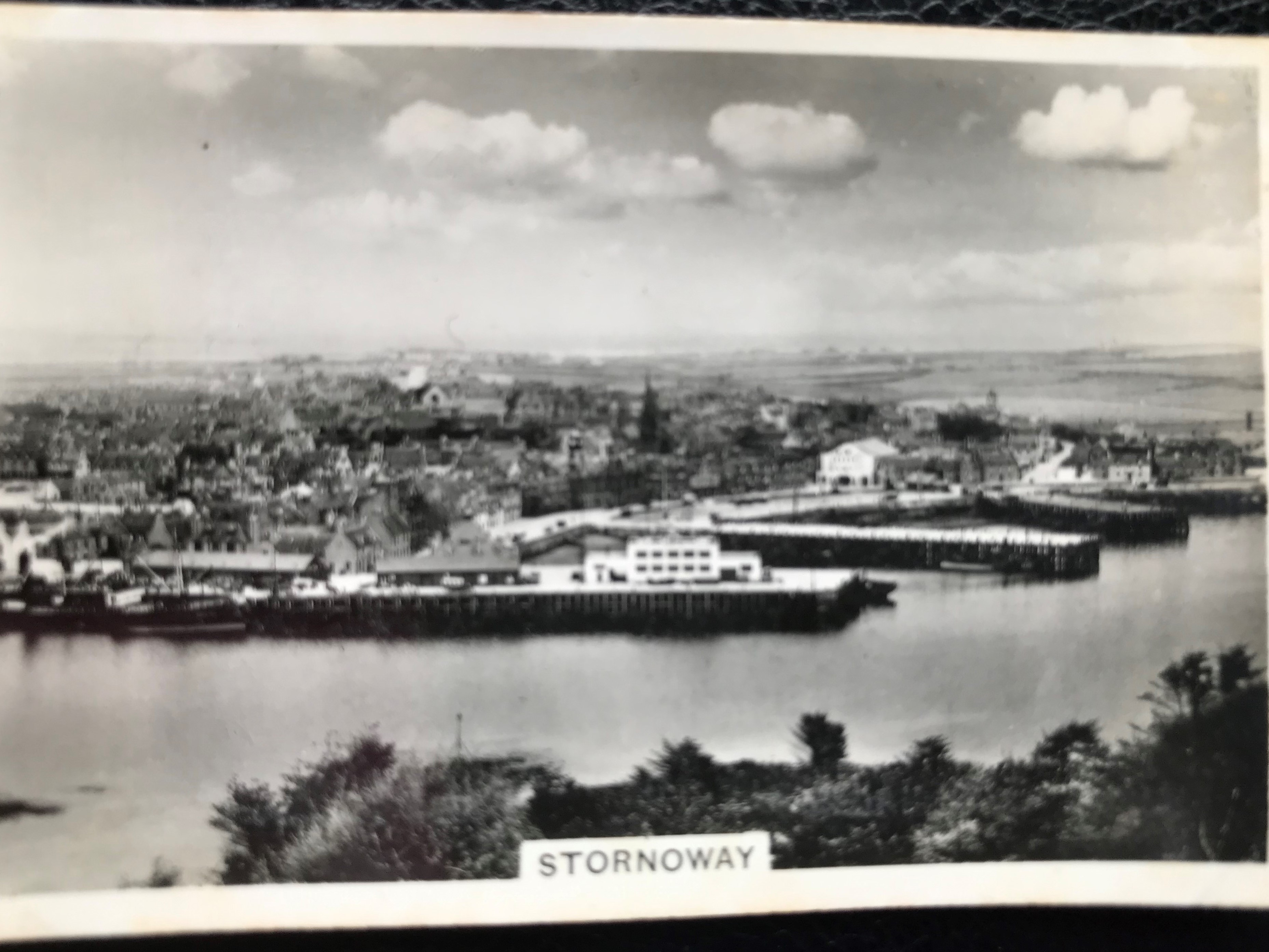
I visited Lewis as part of West Coast trip by public transport in 1999 and to help with a botany survey of the NW coast in 2017, hopping on / off Calmac ferries from Ullapool to Stornoway and this 1939 view.
Old lazy beds are often seen in the landscape which were cultivated by hand to grow crops such as potatoes and fertilised with sea-weed.Another 1939 card from Ardgour in Argyllshire shows ploughing by horse on a croft.
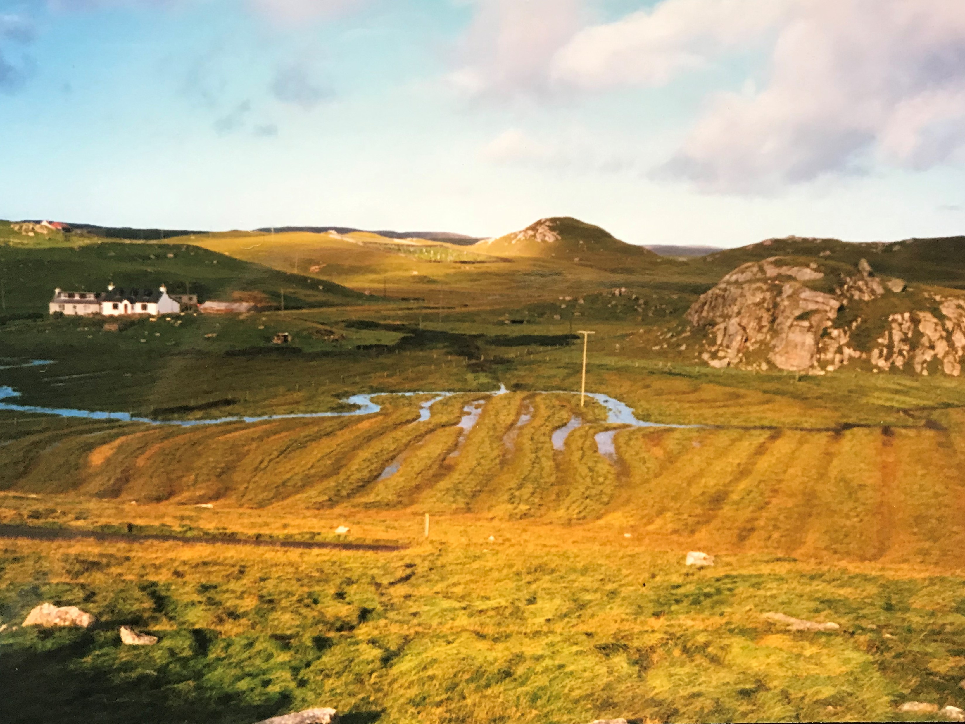
Near Timsgearraidh West Lewi


In 1999, I had nice weather visiting famous white beaches such as Traigh Uuighe and coastline near Bhaltos.

Glen Bhaltos
The 2017 trip hit very bad weather. We lived on board an ex inshore fishing boat with the aim of easier access to remote headlands and islets.

BSBI August 2016 – MV Cuma sheltering Loch Raisort from gales

BSBI August 2016 view from Scarp -brief good weather interlude
0 Comments